The hurricane season usually starts in June in the Caribbean. Many sailors will chose to stay where they are, hoping for the best. Some will sail away and spend their time during the hurricane season in the south of the Caribbean like Trinidad where the likelihood to get hit by a hurricane is lower. Some will go to Aruba, Bonaire or Curaçao that are out of the way of the hurricanes. Some will continue the journey towards Central America. Some will jump into the Pacific through Panama Canal and sail to French Polynesia. Others like us, will go to Europe.
Soon, our cruising adventure in the Caribbean will leave place to ocean sailing again. The weather in the North Atlantic is rough during the winter season but it normally eases down during spring, opening routes for the sailboats aiming to get to Europe from the Caribbeans or from North America in more comfortable conditions.
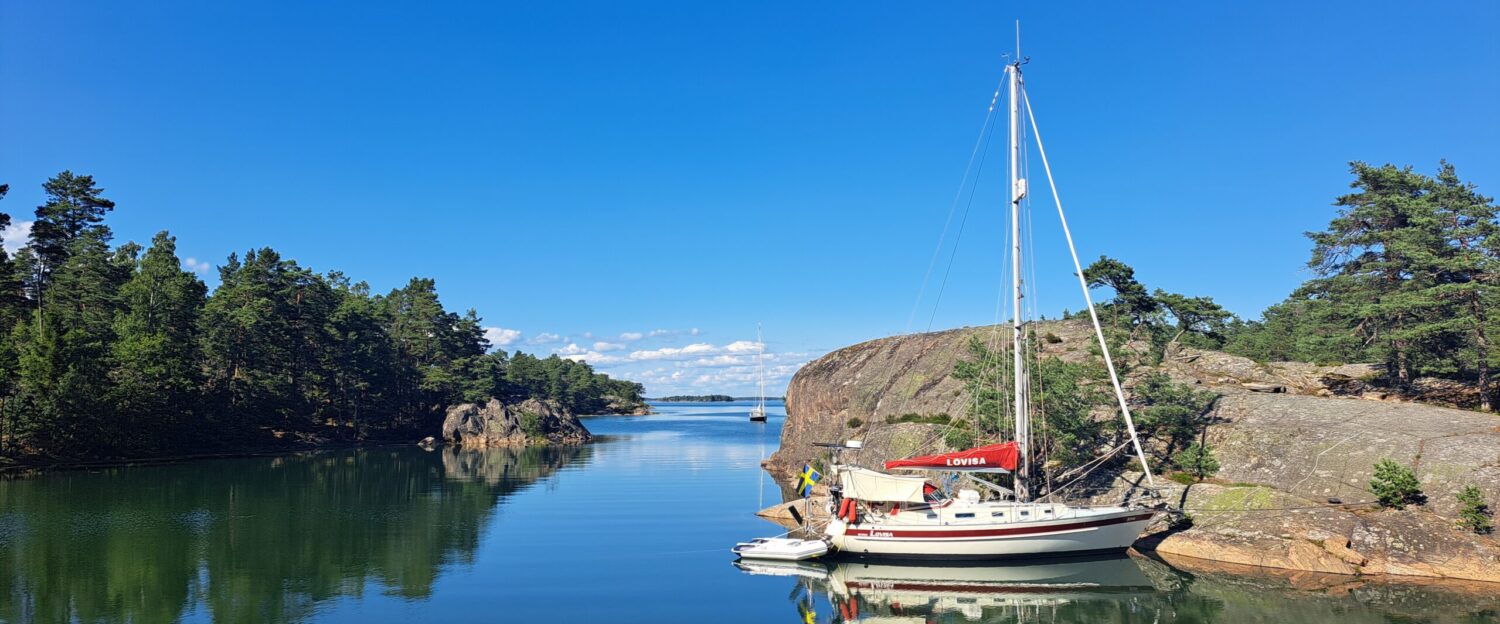
We chose to wait for our weather window nearby Saint Martin. The choice of Saint Martin was mostly driven by the availability of well furnished grocery stores with reasonable prices and plenty of sailboat chandlers. We plan to make our landfall in Europe in Cork but we intend to split the crossing into three legs. From Saint Martin we will head north toward Bermuda that is positioned some 850 Nm away to make a first stop. This passage should take approximately 7 days sailing at 5 knots. We will wait there for a good weather window to proceed towards the Azores 1850 Nm away. This longer passage should normally take 15 days with a speed of 5 knots. After some rest in the Azores, we will wait for a new weather window to set sail towards Cork 1200 Nm away avoiding the Bay of Biscay on the route. We expect this passage to take around 10 days.
We are not meteorologists so we had to study quite a bit to understand how to build our plan in best conditions. For our first leg towards Bermuda, we need to wait for the temperatures over North America to increase. The winds driven by the semi-permanent high pressure system of the Azores get warmer as they travel through the lower latitudes. Regularly this warm air will meet the colder air that is circulated by another high pressure system that comes from North America. The meeting of these two generates cold fronts characterized by strong winds that have a direction that is very unfavorable for getting to Bermuda. These strong winds also bring heavy seas that we would rather avoid. The frequency and the intensity of these cold fronts will reduce as the air coming from North America will get warmer, allowing better sailing conditions to reach Bermuda.
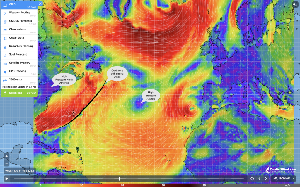
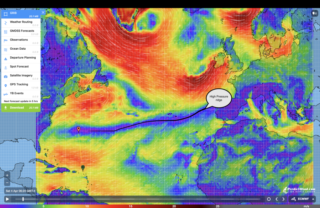
Another important phenomenon we will have to keep an eye on is the high pressure ridge, an extensive area of calm that often appears over the Atlantic Ocean. There are two ways to get out of one: wait for the ridge to move which can take several days, or run the engine to get out of it, making sure to use the fuel to reach areas with stable wind conditions even if this adds distance to the destination. This ridge is important mostly for the leg from Bermuda to the Azores because it is a longer leg and the risk is higher of getting stuck in one of these.
The departure time from Bermuda to the Azores will be driven by the behavior of the low pressure systems that builds up along the east coast of the United States. During winter time these low pressure systems are forming at relatively lower latitudes compared with summer time and they disturb the high pressure system of the Azores, making winds more variable and unpredictable on the route to the Azores. As these low pressure cells tend to move further north beginning of spring, the high pressure of the Azores will stabilize offering more predicable and steadier weather conditions.
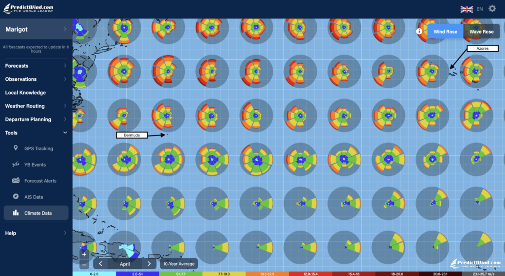
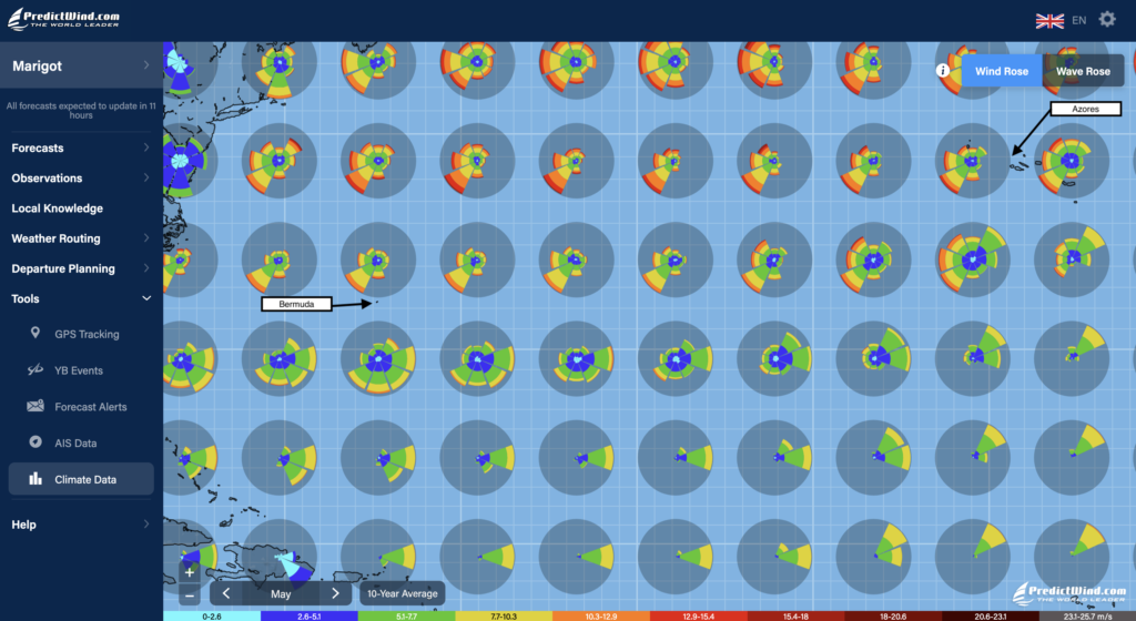
The statistical weather data that are also available via PredictWind tell a little bit the same story. The climate data tool of PredictWind represents the likelihood of encountering winds from a certain direction and with a certain strength as polar diagrams on the map. We show the ones for April, May and June below.
For the first leg from Saint Martin to Bermuda, these diagrams show that statistically, from April to May, the risk to face strong winds from the north drops dramatically and this is why May is statistically a better month for departure than April and the months before. This doesn’t mean that a departure in April is impossible, it is just statistics, and weather windows could turn up in the forecast.
For the second leg from Bermuda to the Azores, the polar diagrams also show a dramatic change of weather conditions from April to May on the latitude of Bermuda and on the latitude of the Azores: While winds tend to come from all directions in April, they are more stable in May and even more in June, predominantly from south west.
Another interesting piece of information that these polar diagrams show is the probability of calms: areas on the map where polar diagrams have more blue at the center and even turquoise are areas where there is a higher chance to end up in a calm. These zones should be avoided as much as possible. This is the reason why taking a direct route straight from Saint Martin to the Azores in April, May or June is not the best route to take unless one has plenty of fuel to run the engine for several days.
A relevant risk of calms also exists on our route from Saint Martin to Bermuda. However, this passage is relatively short and weather prediction models sufficiently accurate for us to be able to time a departure to not likely end up in one of these. In any case, we will carry sufficient diesel in case we do.
From Bermuda to the Azores in May or June, these statistical diagrams show that the likelihood of calms is higher if we take a direct route from Bermuda to the Azores compared with a recommended route that would go north east from Bermuda nearly until the latitude of the Azores and then straight toward east to the Azores.
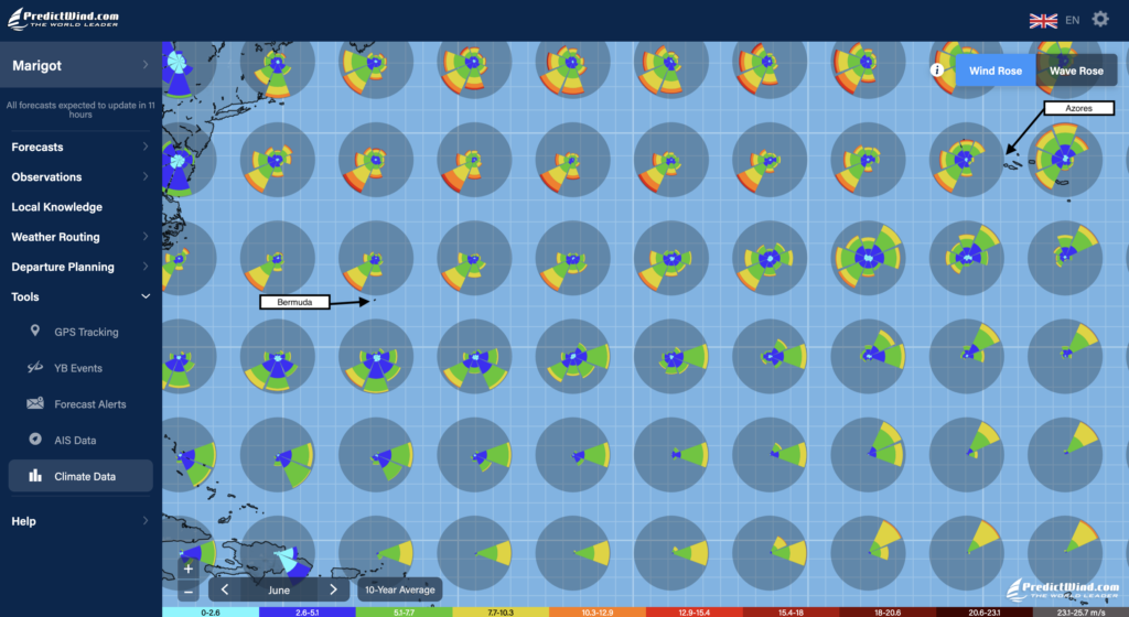
The weather for the final Atlantic leg from the Azores to Cork is expected to be more variable. In June and July, winds tend to come predominantly from the western quadrant (westerlies) but are known to be very variable in strength. The most important for this leg will be to not end up in Bay of Biscay and its unpredictable weather conditions. On the route to Cork, if we are hit by gale force winds we may need to sail along that wind. That is normally one of the safest things to do. If that wind is blowing in direction of Bay of Biscay, then after a few days we could eventually end up in Bay of Biscay.
So from the Azores to Cork, the strategy will be to look for a weather window that can allow us to sail nearly straight north for a few days to build margin towards Bay of Biscay in case we need to sail along gale force winds. Some sailors recommend not to try to head toward final destination prior to getting close to latitude 45 degrees north (Latitude of Bordeaux).